documentation segmentation on the pointclouds.org website
A point cloud is a data structure used to represent a collection of multi-dimensional points and is commonly used to represent three-dimensional data. In a 3D point cloud, the points usually represent the X, Y, and Z geometric coordinates of an underlying sampled surface. When color information is present, the point cloud becomes 4D.
Point clouds are most often created by 3D scanners. Point clouds can be directly rendered and inspected, but generally they are not directly usable in most 3D applications, and therefore are usually converted to polygon or triangle mesh models, NURBS surface models, or CAD models through a process commonly referred to as surface reconstruction.
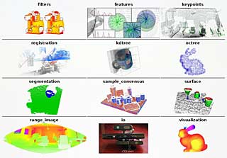
Here comes in the Point Cloud Library (PCL), a standalone, large scale, open project for 3D point cloud processing. The PCL framework contains numerous state-of-the art algorithms including filtering, feature estimation, surface reconstruction, registration, model fitting and segmentation, as well as higher level tools for performing mapping and object recognition. PCL is released under the terms of the BSD license and it’s free for commercial and research use.
The PCL website provides a blog, a news, media and download section and a great documentation with tutorials, descriptions, API’s and advanced topics about 3D point clouds.
One example of a PCL project is the open source version of KinectFusion.

